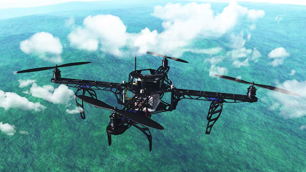
Drone mapping, especially for creating accurate 3D models, orthomosaics, and surveying maps, requires precise camera settings to ensure the best possible data quality. The settings depend on factors like the type of drone, environmental conditions, and the area being mapped. Below are the essential drone camera settings to optimize for mapping and photogrammetry.
1. Drone Mapping Camera Settings: Resolution (Image Quality)
- Recommended Setting: High resolution (20 MP or higher)
- Why:
- High-resolution images are crucial for creating detailed maps. Higher resolutions capture more pixel information, which helps with the accuracy of measurements, creating sharper details, and producing high-quality 3D models.
- Standard 20 MP or above is a good range for most mapping drones, but higher resolutions (e.g., 48 MP or 50 MP) provide even more detail.
- Example:
- DJI Phantom 4 RTK: 20 MP camera
- DJI Air 2S: 50 MP camera
2. Drone Mapping Camera Settings: Shutter Speed
- Recommended Setting: Fast shutter speed (1/500 to 1/1000 sec)
- Why:
- A fast shutter speed ensures sharp images without motion blur, which is important when mapping dynamic areas or flying at higher speeds. You’ll typically want to avoid blurry images during the mapping process.
- 1/500 to 1/1000 sec is a good range to ensure clarity, particularly when the drone is moving during a survey.
- Tip:
- For stationary shots or when the drone is hovering, you can use a slightly slower shutter speed (e.g., 1/250 sec), but for moving drones, use faster speeds.
3. Drone Mapping Camera Settings: ISO (Light Sensitivity)
- Recommended Setting: ISO 100 to 400
- Why:
- Keep the ISO low to minimize noise and maintain sharpness in the images. Lower ISOs (e.g., ISO 100 or 200) are ideal in bright conditions and will help ensure clean, crisp images.
- ISO 400 can be used if the light is lower (e.g., overcast days or in the evening), but avoid going above ISO 800, as this can introduce visible noise.
- Tip:
- Avoid increasing ISO unnecessarily to prevent grainy images. If shooting in dim conditions, use longer shutter speeds instead.
4. Drone Mapping Camera Settings: White Balance
- Recommended Setting: Manual White Balance (5500K or Daylight)
- Why:
- White balance should be set manually to ensure consistent colors throughout the mapping process. If the white balance is left on Auto, the camera may adjust itself during the flight, leading to color inconsistencies between images, which can affect the photogrammetry results.
- 5500K (Daylight) is ideal for sunny conditions, but you can adjust this slightly if you’re mapping in cloudy or shaded conditions.
- Tip:
- Set the white balance based on the environment and adjust it if conditions change. For cloudy conditions, set the white balance to Cloudy (6000K).
5. Drone Mapping Camera Settings: Camera Angle (Field of View)
- Recommended Setting: Vertical (90°) or Oblique (45°)
- Why:
- For accurate mapping, you generally want to capture the ground directly below the drone, so vertical shots (90° angle) are ideal for creating accurate ortho photos and 3D models.
- However, if you’re capturing more dynamic or larger landscapes (e.g., construction sites), you might want to tilt the camera to a 45° angle to include both the ground and surrounding features.
- Tip:
- Use a fixed camera angle (do not adjust during the flight) to ensure consistency across all images.
6. Drone Mapping Camera Settings: Overlap and Flight Path
- Recommended Setting: 80-90% front and side overlap
- Why:
- Overlap is critical for photogrammetry. To ensure successful image stitching and accurate 3D modeling, you need a high level of overlap between consecutive images, ideally 80-90% front overlap and 70-80% side overlap.
- High overlap ensures that the software has enough common data points to align the images correctly.
- Tip:
- Most drone flight planning software (e.g., DJI GS Pro, Pix4D, Drone Deploy) will allow you to adjust the overlap percentage. Stick to the recommended 80-90% for best results.
7. Drone Mapping Camera Settings: Exposure Settings (Auto or Manual)
- Recommended Setting: Manual Exposure or Auto Exposure Lock (AEL)
- Why:
- Manual exposure gives you full control over the settings, ensuring consistency throughout the mapping flight. Avoid using auto exposure, as the camera will adjust settings during flight, potentially causing inconsistency in the images.
- Auto Exposure Lock (AEL) ensures that the exposure remains constant during the entire flight, which is especially important when the lighting conditions change (e.g., passing through areas with shade or sunlight).
- Tip:
- If you do use Auto Exposure, make sure to lock it at the start of the flight.
8. Drone Mapping Camera Settings: GPS and Geo tagging
- Recommended Setting: Enable GPS & Geo tagging
- Why:
- Geo tagging is essential for accurate mapping. The drone’s camera should record GPS coordinates (latitude, longitude, and altitude) for each image it takes. This geospatial information is used during post-processing to align and stitch the images into a seamless map.
- Many mapping drones (like DJI Phantom 4 RTK) come with real-time kinematic (RTK) technology, which provides highly accurate positioning data.
- Tip:
- Ensure that the drone’s GPS system is functioning and that geo tagging is enabled in the camera settings before flight.
9. Drone Mapping Camera Settings: File Format (Image Type)
- Recommended Setting: RAW or TIFF
- Why:
- When performing photogrammetry, it’s best to use RAW or TIFF files instead of JPEG, as these formats retain more data, allowing for better post-processing and greater accuracy during image stitching.
- JPEG images are compressed and lose some detail, which can negatively impact the precision of the map, especially when zooming into fine details.
- Tip:
- If you’re in a rush or don’t need the extra data for detailed mapping, you can use JPEG, but for high-accuracy results, stick with RAW or TIFF.
10. Drone Mapping Camera Settings: Gimbal Settings
- Recommended Setting: Fixed Gimbal or Slight Tilt
- Why:
- To ensure consistency across all images, you should have a fixed gimbal setting during the flight. Avoid dynamic gimbal movements that could change the angle between images and cause alignment issues.
- If you’re capturing a large area, you might want to slightly tilt the gimbal to improve coverage, but avoid aggressive adjustments during the flight.
- Tip:
- Test the gimbal angle before starting the flight to ensure that it’s set correctly.
11. Drone Mapping Camera Settings: Time of Day
- Recommended Setting: Golden Hour (early morning or late afternoon)
- Why:
- The golden hour provides soft, diffused lighting, reducing harsh shadows and enhancing the detail in the landscape. If you’re mapping in bright sunlight or midday, the harsh light can cause overexposure and shadows, which can distort your map.
- Early morning or late afternoon light conditions are ideal for mapping tasks.
- Tip:
- If shooting in midday sunlight, consider using ND filters to reduce glare and keep exposure levels in check.
12. Drone Mapping Camera Settings: Camera Calibration
- Recommended Setting: Calibrate the Camera and IMU
- Why:
- Regular calibration of the camera and Inertial Measurement Unit (IMU) ensures that the drone’s sensors are providing accurate data. Proper calibration is critical for high-precision tasks like mapping and surveying.
- Tip:
- Perform calibration before each flight, particularly if the drone was transported or stored for an extended period.
13. Drone Mapping Camera Settings: Flight Speed and Altitude
- Recommended Setting: Flight Speed: 3 to 5 m/s (about 10 to 18 km/h)
- Altitude: 100-120 meters (or per local regulations)
- Why:
- Flight speed influences the quality of the captured images. A slower flight speed ensures the camera has enough time to take sharp, detailed photos with high overlap. Flying too fast might result in blurry images and insufficient overlap.
- Altitude should be set based on the size of the area you are mapping and the drone’s sensor capabilities. For high-resolution images and clear mapping, flying at 100-120 meters typically works well. Ensure you’re compliant with local regulations as altitude limits can vary by location.
- Tip:
- If covering a very large area, adjust altitude higher to capture a broader view, but keep the overlap ratio consistent.
14. Drone Mapping Camera Settings: ND Filters (Neutral Density Filters)
- Recommended Setting: ND16 or ND32
- Why:
- In bright daylight, ND filters are essential for reducing exposure and preventing overexposure, while also allowing the drone’s camera to maintain the correct shutter speed. ND filters reduce the amount of light entering the lens without altering the color of the image, which is especially important when flying in sunny conditions.
- ND16 filters are great for moderately bright environments, and ND32 is better for extremely bright sunlight or midday flights.
- Tip:
- Use ND filters only when needed. Overusing them may darken your images unnecessarily.
15. Drone Mapping Camera Settings: Image Stitching Considerations
- Recommended Setting: Ensure even overlap (80-90%)
- Why:
- Proper image overlap is vital for successful stitching. If the overlap between images is too low (less than 70%), the photogrammetry software may struggle to align them, resulting in incomplete or poor-quality maps.
- 80-90% overlap is optimal to create seamless models and accurate 3D reconstructions. Ensure the images you capture have sufficient overlap to give the photogrammetry software enough reference points for stitching.
- Tip:
- Plan your flight path and set the overlap percentages in your flight planning software before takeoff to avoid missing key data points.
16. Drone Mapping Camera Settings: Drone Positioning (Manual or Autopilot)
- Recommended Setting: Use Autopilot for Consistency
- Why:
- To ensure the consistency of camera angles, altitude, and speed during the mapping process, it’s best to use the autopilot or mission planning software to pre-program the flight path.
- Manual flying might introduce slight variations in the camera’s angle and speed, making it more difficult to create accurate and precise maps.
- Tip:
- Using DJI GS Pro, Pix4D Capture, or Drone Deploy can automate the entire flight and camera settings, ensuring uniformity.
17. Drone Mapping Camera Settings: Photogrammetry Software Considerations
- Recommended Setting: Ensure Compatibility with Mapping Software
- Why:
- The settings you choose on the drone should align with the requirements of your photogrammetry software. For example, software like Pix4D or Agi soft Meta shape requires specific image overlaps, resolution, and GPS accuracy for the best results.
- Some software packages allow you to adjust settings such as photo intervals or camera calibration before flight, so check that these parameters match your needs.
- Tip:
- If you’re working with specialized software (e.g., RTK), make sure your drone and camera support the necessary data output formats (e.g., geo tagged images, GPS coordinates, and EXIF metadata).
18. Drone Mapping Camera Settings: Camera Calibration for Accurate Data
- Recommended Setting: Calibrate the Camera before Every Flight
- Why:
- Ensuring that your camera and IMU (Inertial Measurement Unit) are calibrated regularly guarantees accuracy in the mapping process. A mis calibrated camera can distort images or cause errors in photogrammetry processing, affecting the final map or model.
- Calibration typically involves aligning the camera and sensors for optimal accuracy in geo referencing images.
- Tip:
- Always follow the manufacturer’s recommended calibration procedure before each flight, particularly when working in challenging environments or after extended storage.
19. Drone Mapping Camera Settings: Image Capture Interval
- Recommended Setting: Interval of 3 to 5 seconds between images
- Why:
- To prevent too many overlapping images while ensuring enough data, set the interval between photos to 3-5 seconds. This gives enough time for the drone to move while maintaining sufficient overlap.
- A too-short interval may create excess overlap or multiple images for the same area, while too long an interval might lead to insufficient coverage.
- Tip:
- Use flight planning apps to automate and optimize your image capture interval. Software like DJI Terra and Pix4D help in pre-setting this based on flight speed and altitude.
20. Drone Mapping Camera Settings: Weather Conditions and Planning
- Recommended Setting: Check for Stable Weather Conditions
- Why:
- Weather is one of the most critical factors influencing drone mapping. Wind, rain, and low visibility can affect drone stability and image quality.
- Stable weather (clear skies, low winds) is essential to ensure the drone flies steadily and the camera can capture sharp, accurate images.
- Tip:
- Always check the weather forecast before heading out. Avoid flying in high winds, rain, or fog, as these can degrade image quality and cause alignment errors in the final map.
21. Drone Mapping Camera Settings: Post-Processing Considerations
- Recommended Setting: Process with GCPs (Ground Control Points)
- Why:
- Ground Control Points (GCPs) are physical reference points marked on the ground, and using them in post-processing helps improve the geo referencing accuracy of your map.
- GCPs are essential for precise geospatial accuracy, particularly in applications like surveying or construction mapping.
- Tip:
- Place GCPs throughout the survey area before you fly and record their positions using RTK or PPK (Post Process Kinematic) data for maximum accuracy.
22. Drone Mapping Camera Settings: Automated Flight Planning
- Recommended Setting: Use Mission Planning Software
- Why:
- Mission planning software can optimize flight paths, ensure consistent overlap, and adjust camera settings based on altitude, terrain, and image capture requirements.
- Software such as Drone Deploy, Pix4D Capture, or Litchi allows you to automate the entire mission, including altitude, flight speed, and image interval, ensuring precise data collection.
- Tip:
- Ensure that your mission plan takes into account obstacles, airspace regulations, and battery life. Always have contingency plans for unexpected weather or flight conditions.
23. Drone Mapping Camera Settings: Battery Life and Flight Time
- Recommended Setting: Plan for Multiple Flights if Necessary
- Why:
- Battery life is always a limiting factor in drone mapping. While many drones offer 30 to 45 minutes of flight time, large areas may require multiple battery changes.
- Plan the mission to include battery swaps or multiple flight legs to ensure complete coverage of the area.
- Tip:
- Use high-capacity batteries and plan flight legs with battery life in mind to prevent running out of power mid-flight.
24. Drone Mapping Camera Settings: Avoiding Lens Distortion
- Recommended Setting: Avoid Wide-Angle Distortion
- Why:
- Wide-angle lenses can create lens distortion near the edges of the images, which can interfere with the photogrammetry process. This distortion can make it harder for software to stitch images together accurately.
- If possible, use a drone camera with a narrower field of view or opt for software that automatically compensates for lens distortion.
- Tip:
- When using wide-angle lenses, make sure the camera is level and perpendicular to the ground to reduce distortion.